
Wandern in Bayern – Über das Immenstädter Horn
Wo es rauf geht, da geht es auch wieder runter: Über das Immenstädter Horn in Bayern hat uns gezeigt, was es bedeutet einen Gipfel zu besteigen und ihn auch wieder hinabzugehen. Belohnt wurden wir auf den 15 km in den Allgäuer Voralpen von Aussichten, Tieren und der Erfahrung an sich.
Eigentlich sollten wir um diese Zeit unterwegs sein in Hawaii, in unseren Flitterwochen – bedingt durch die gegenwärtige Pandemie, haben wir alles um ein Jahr verschoben und hatten dieses Jahr dann das Glück, mit einem gemieteten Camper nach Bayern fahren zu können. Das erste Mal in unserem Leben fahren wir also in die Welt der Berge und Seen um die Natur ein wenig zu erfahren.
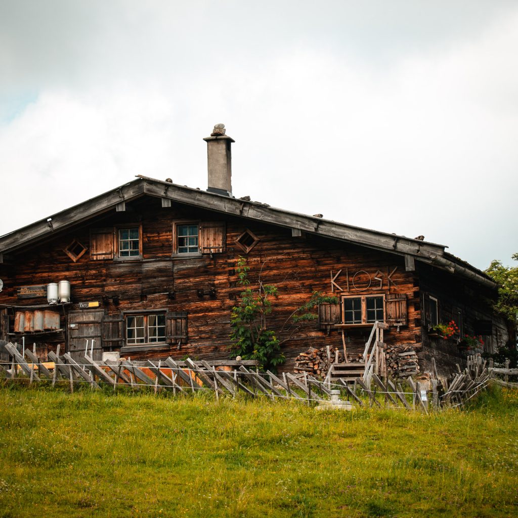
Bühl am Alpsee ist unser Startpunkt

Unser Startpunkt ist gleichzeitig unser Campingplatz am großen Alpsee, wir laufen also die ersten 2 km durch Bühl, vorbei an wunderbar urigen Häusern, Landheimen und einigen Ferienwohnungen, bis wir kurz nach dem Schul-Landheim im Ort auf den ersten „Wanderweg“ gelangen. Nicht mal 100 Meter auf diesem Weg, werden wir „Dorfkinder“ von den ersten Allgäuer Kühen mit originaler Kuhglocke überrascht und sind hell auf begeistert. Sogleich nutzen wir die Gelegenheit und schießen ein paar Fotos der gemählich am Gras kauenden Rinder, eine Insta-Story darf dabei natürlich auch nicht fehlen.
Schon nach den ersten Kilometern ist es, mit einer kleinen Drehung zum zurückgelegten Weg, möglich auf den großen Alpsee und die dahinterliegende Landschaft zu schauen und das Lichtspiel zwischen Sonne und Wolken auf den umliegenden Bergen zu beobachten. Ein absolut positiv stimmendes Zeichen für den vor uns liegenden Weg.
Nebel, Wolken und Sonne auf der höher gelegenen Strecke und unsere erste klein Snack-Pause
Nach rund 4 km Gesamtstrecke treffen wir auf die erste Almhütte, zu dieser Zeit leider geschlossen, aber wir entschließen uns bei dem tollen Wetter trotzdem eine kleine Rast einzulegen und ein paar Kleinigkeiten zu essen (Nüsse und Süßigkeiten). Wir sitzen im Gras auf einer mitgebrachten Picknickdecke und sinnieren etwas über die wunderschöne Landschaft und unser Glück, dass wir diese Wanderung gestartet haben. Die Hütte (Alpe Gschwenderberg), auf die wir Blicken sieht sehr urig aus und wir sind etwas traurig, dass wir dort kein erfrischendes Pils genießen können.
Wir machen uns weiter auf den Weg, passieren die Berghütte Hornklause und die Rabennest Alpe und stoßen hier erstmals auf nicht eingezäunte, sehr entspannt wirkende Rinder. Zu hören waren diese bereits weit vorher, denn die Glocken um ihre Hälse sorgen dafür, dass man genau weiß, wo sich die friedfertigen Tieren grade aufhalten. Unserer Begeisterung lassen wir hier freien Lauf, sodass wir die Gelegenheiten nutzen Fotos und Videos von und mit den Kühen zu machen.

An dieser Stelle sei auf jeden Fall schon einmal gesagt, dass die Bilder in diesem Bericht bei weitem nicht das Gefühl und die Landschaft der Wanderung widerspiegeln, sondern lediglich eine Idee geben können, wie toll es in den Bergen ist.
Abweichung von der geplanten Route auf eine steile Abkürzung.
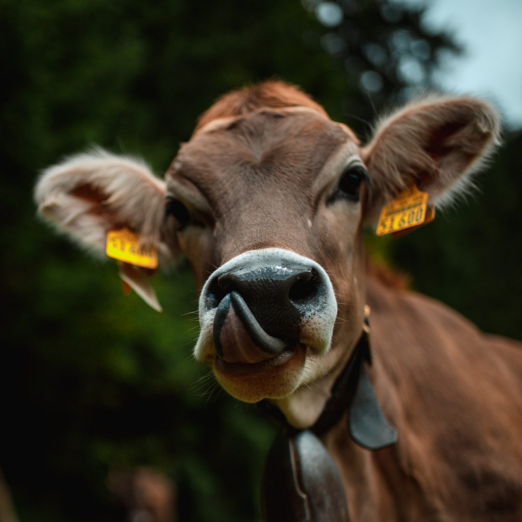
Unsere Route führt uns in die Wälder am Hang, über einen kleinen Bach mit zugehörigem Wasserfall und wird erneut von unglaublich neugierigen Kühen (und wunderschönen Fotomotiven) nach ca. 6,5 km Gesamtstrecke an der Kassel-Alpe unterbrochen – natürlich fällt es uns leicht hier eine kleine Pause zum Fotografien und Filmen der Tiere zu machen.
Hier entscheiden wir uns unseren Weg etwas abzukürzen und nehmen den steileren Weg, der uns direkt zum Gipfel des Immenstädter Horn führen wird. Auf dem recht beschwerlichen Weg, die kürzere Strecke hinauf fällt uns auf, wie viele Schmetterlinge es hier gibt. Scheinbar fühlen sind die farbenfrohen Falter in der gesunden Luft der Alpen richtig wohl…
Auf den nächsten zwei Kilometern unserer Wanderung sehen wir ein Segelflugzeug, fast auf Augenhöhe, das wir zuvor von weit unten bereits einmal sehen konnten. Diese Erfahrung ist insofern beeindruckend, da dies unser erster Berg ist, bei dem wir über 600 Höhenmeter zurücklegen.
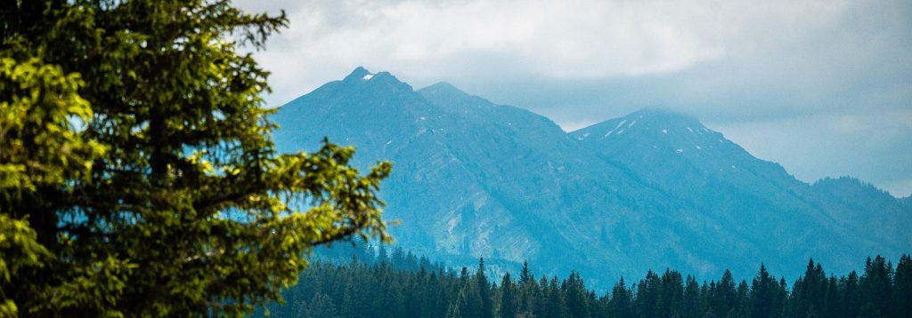
Die Abkürzung bietet, neben der kürzeren Strecke, auch wunderbare Blicke auf das unter uns liegende Bühl und die bereits durchschrittenen Pfade, sowie auf die in der Ferne liegenden Gipfel, auf denen wir sogar etwas Schnee ausmachen können. Bei diesen Größen fühlen wir uns etwas demütig und sind froh, dass wir dieses Abenteuer gemeinsam wagen.
Endlich am Gipfel, gefolgt von einer lehrreichen Erkenntnis

Nach fast 8 km Strecke und etwas mehr als 3 1/2 Stunden sind wir endlich auf dem Gipfel des immentaler Horn angelangt. Am Gipfel breiten wir wieder unsere Picknickdecke aus und genießen unseren Proviant, den wir uns für den Gipfel aufgespart haben. Wir schießen einige Fotos und erstellen erneut wieder Videomaterial für unsere Social Media Kanäle. Wir blicken hinunter auf den großen Alpsee, unseren Campingplatz, Bühl und die so weitläufige Landschaft hinter dem großen Alpsee.
Als wir uns nach dieser Pause wieder auf den Weg Richtung Bühl machen, wird unser vor uns liegender Weg von einer sehr wichtigen Erkenntnis begleitet: Wanderstöcke sind hilfreich, das können wir sagen, da wir keine haben und teilweise recht unbeholfen den Weg beschreiten und: Das wirklich anstrengende ist nicht der Aufstieg, sondern vielmehr der Abstieg. Als wir wieder am großen Alpsee angekommen sind, sind unsere Beine recht weich und wir sind rund 15km in über 7 1/2 Stunden gelaufen, gewandert und gerutscht. Wir gönnen uns am großen Alpsee noch ein (echt leckeres) Eis und kommen grade rechtzeitig an unserem Campingplatz an, als es anfängt zu regnen – Glück gehabt!
Wenn Du den Weg, den wir genommen haben, auch wandern willst, kannst Du dir die AllTrails-Tour hier ansehen oder die GPX-Datei direkt herunterladen und in dein Wanderprogramm einfügen.